

Sriharikota, Andhra Pradesh
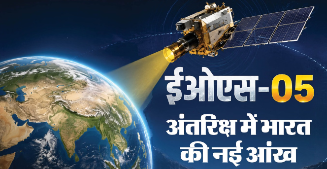
India has achieved another significant milestone in the space sector. The Indian Space Research Organisation (ISRO) has successfully launched the EOS-05 Earth observation satellite aboard the GSLV-F17 rocket. The mission is considered significant because EOS-05 has been designed for Earth imaging from a geosynchronous orbit. This capability could enable repeated observation of large areas of the Earth and help monitor changes taking place across different regions.
But how exactly will EOS-05 work? What is a geosynchronous orbit, and how will the satellite reach it? Let’s understand the process in simple terms.
What Is EOS-05?
EOS-05 is an advanced Earth observation satellite designed primarily to capture images and collect data about the Earth from space. It weighs approximately 2,367 kilograms and has been developed specifically to obtain Earth imagery and related data from a geosynchronous orbit.
The mission was carried out by New Space India Limited (NSIL) as a dedicated launch for a strategic user. In addition, 18 co-passenger satellites belonging to users in India and other countries were launched as part of the mission.
One of EOS-05’s key features is that once it reaches its designated orbit, it will be able to repeatedly observe a large portion of the Earth. This could help monitor changes occurring in a particular region over time.
What Does “Imaging” Mean in a Satellite?
Imaging does not simply mean taking ordinary photographs with a camera. Sensors onboard satellites record different types of information received from the Earth’s surface. After this data is processed, scientists and relevant agencies can analyse images and other useful information about the planet.
For example, during a flood, satellite imagery can help determine how large an area has been inundated and which regions have been affected. Similarly, in the event of a forest fire, satellite data can be used to monitor the affected area and track the spread of the fire.
In agriculture, satellite imagery can help study crop conditions and changes in vegetation. In environmental monitoring, satellite data can also help researchers understand long-term changes in land and vegetation.
What Is GSLV-F17?
GSLV-F17, the launch vehicle that carried EOS-05 into space, is the 19th flight of India’s Geosynchronous Satellite Launch Vehicle (GSLV). The rocket is approximately 51.7 metres long and has a lift-off mass of around 420.5 tonnes.
It was launched from the Second Launch Pad at the Satish Dhawan Space Centre in Sriharikota. The upper section of the rocket featured an ogive composite payload fairing approximately four metres in diameter, inside which EOS-05 was securely housed.
How Do the Three Stages of GSLV-F17 Work?
GSLV-F17 has three main stages. The first stage, known as GS-1, consists of an S-139 core and four L-40H strap-on units. During liftoff, their engines provide the thrust required to propel the rocket upward at high speed.
Once the first stage completes its job, GS-1 separates from the vehicle. The second stage, GS-2, then becomes active and uses the GL-40HT engine.
After the second stage separates, the third stage, GS-3, takes over. It is known as CUS-15 and uses liquid hydrogen and liquid oxygen as propellants.
Once the third stage completes its burn, EOS-05 is deployed into the designated sub-geosynchronous transfer orbit, or sub-GTO.
What Is an Orbit?
An orbit is the predetermined path along which a satellite travels around the Earth. The orbit selected for a satellite depends on its intended purpose.
Satellites operating in lower orbits can generally capture more detailed images of the Earth’s surface, but they move relatively quickly across the planet. At higher altitudes, satellites can observe a much larger portion of the Earth at the same time.
EOS-05 is intended to reach a geosynchronous orbit to enable repeated monitoring of a large area.
What Is a Sub-GTO?
GSLV-F17 does not place EOS-05 directly into its final geosynchronous orbit. Instead, the rocket first places the satellite into a sub-geosynchronous transfer orbit, or sub-GTO.
This is an elliptical orbit in which the satellite’s distance from Earth is not constant. At one point, the satellite is closest to Earth, known as the perigee, while at another point it is farthest from Earth, known as the apogee.
The specified sub-GTO for EOS-05 has a perigee of approximately 170 kilometres and an apogee of around 28,934 kilometres.
The sub-GTO is not EOS-05’s final orbit. It is a transfer orbit used to initially position the satellite. After deployment, the satellite uses its own propulsion system to gradually modify its orbit.
How Will the Satellite Reach Its Final Orbit?
The mission does not end once EOS-05 separates from GSLV-F17. The satellite’s onboard propulsion system is used to perform orbital manoeuvres as required.
Through a series of engine burns, the satellite’s velocity and orbit are adjusted. Its altitude and orbital shape are gradually modified until it reaches its designated geosynchronous orbit.
In other words, the primary role of GSLV-F17 is to carry the satellite to its initial transfer orbit, while EOS-05 uses its own propulsion system to perform the necessary orbital manoeuvres to reach its final orbit.
What Is a Geosynchronous Orbit?
A geosynchronous orbit is an orbit in which a satellite’s orbital period is approximately equal to the time Earth takes to rotate once on its axis. Earth completes one rotation in about 23 hours, 56 minutes and 4 seconds.
At an altitude of approximately 35,786 kilometres above Earth, a satellite in such an orbit can remain synchronised with the planet’s rotation.
If a satellite travels eastward in a circular orbit directly above the equator with an orbital period matching Earth’s rotation, it appears to remain approximately over the same location when viewed from Earth. Such a special orbit is known as a geostationary orbit.
What Benefits Could EOS-05 Provide to India?
The imagery and data generated by EOS-05 could potentially be used across several important sectors, including:
- Weather monitoring: Tracking changes in weather and atmospheric conditions.
- Cyclones: Providing useful data for monitoring the position and development of cyclones.
- Floods: Assessing affected areas and the spread of floodwaters.
- Forest fires: Monitoring affected regions and tracking the spread of fires.
- Agriculture: Studying crop health and changes in vegetation.
- Environment: Monitoring long-term changes in land and vegetation.
- Disaster management: Helping authorities rapidly assess affected areas following natural disasters.
Why Is the EOS-05 Mission Important?
The importance of EOS-05 goes beyond simply adding another satellite to India’s space programme. Its ability to repeatedly image large areas of the Earth from a geosynchronous orbit could strengthen India’s Earth observation capabilities.
The data could support scientific research, weather and environmental monitoring, agriculture and disaster management. The ability to maintain a broad view of large areas could also have strategic significance.
The successful flight of GSLV-F17 and the deployment of EOS-05 into its designated transfer orbit demonstrate India’s growing technological capabilities in space. The satellite’s subsequent orbital manoeuvres, testing and operational performance will ultimately determine how significantly EOS-05 enhances India’s ability to monitor and study the Earth.